
Beta test our low(er)-stress bike map!
Volunteers on Shift’s Advocacy Committee made a low-stress bike map to help people find routes to get around town. The map isavailable to view on the web, but the best way to use it is with the Bike Streets app foriPhone andAndroid. We’d love community members to download the app, and try out the following things:
Turn-by-turn directions for routes (even ones you already take regularly)
Suggest new routes and vote on other people’s suggestions
Add hazards or notes to the map (including if the router sends you somewhere you wouldn’t recommend!)
When suggesting routes, please think about who you’d recommend a route to. The ideal is routes that you’d send a kid or your grandma on; but at minimum these routes should be suitable for an adult on an e-bike with a child on the back! And as always, ride with caution - while we are doing our best to recommend less-stressful routes, we still have a long way to go on safe bike routes.
Shift is not the only local advocacy organization doing mapping work using the Bike Streets platform. For some inspiration on how the app is being used by other advocates, here are some conversations pulled from other cities.
Bike map chatter
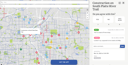
Denver is the oldest user of Bike Streets, so their map is big and quite thorough! This is only a portion of the map, and every bubble icon represents feedback given by bike riders, in addition to the routes suggested (red lines) by riders and accepted (blue lines) by the map team. Riders can agree or disagree with the added notes and suggested routes.
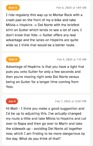
Beyond the yes/no votes, there’s room to discuss the details of suggested routes. Here’s an example from Berkeley, where the exact alignment of a north-south connection is being discussed.
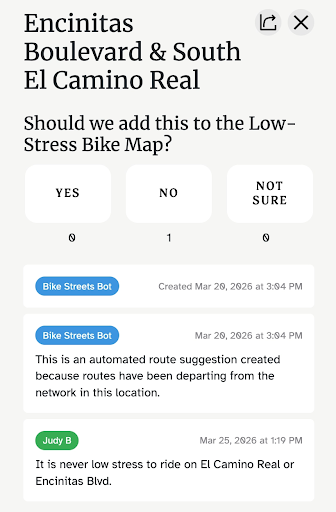
The platform itself also suggests additions to the map when someone routes between destinations that are not currently connected on the network. Sometimes the suggestion bot gets it wrong, though, so it’s useful to provide feedback from lived experience, like this example from Encinitas.
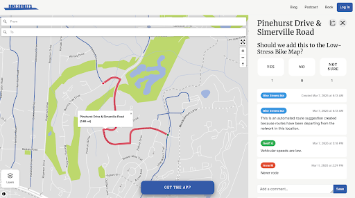
We have an example of automated suggestions here in Chapel Hill, too. A couple of people have weighed in on this suggestion, but if any of our readers have experience with this route, please chime in on the conversation!
Checking out other cities’ maps is a fun way to see how bike riders around the country are getting creative with low-stress connections, even in cities that aren’t famous for being bike friendly (check out Dallas and Houston!). The full list of active maps can be found at https://bikestreets.com/ by hovering over the “Maps” in the top menu bar.
The more people we have contributing their knowledge to our map here in Chapel Hill-Carrboro, the better we can support people interested in biking but intimidated by high-stress connections. Download the app and make the map better!